Free access to election maps and boundary lines
Ordnance Survey (OS) has published the latest iteration of Boundary Line, following the recent review of Parliamentary Constituencies by UK's National Boundary Commission.
OS offers a free-to-use online service, where anyone can explore the electoral geography of the UK, and locate electoral boundaries quickly and easily. Visit Election Maps on our website to launch an interactive map of Great Britain (GB) or Northern Ireland (NI), and select the boundaries you need. Our election map can provide boundaries such as:
- Local Authorities
- Westminster Constituencies (present and future)
- Scottish and Welsh Parliamentary Constituencies and Regions
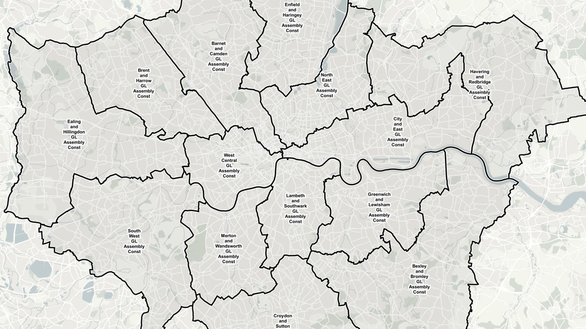
- London Boroughs
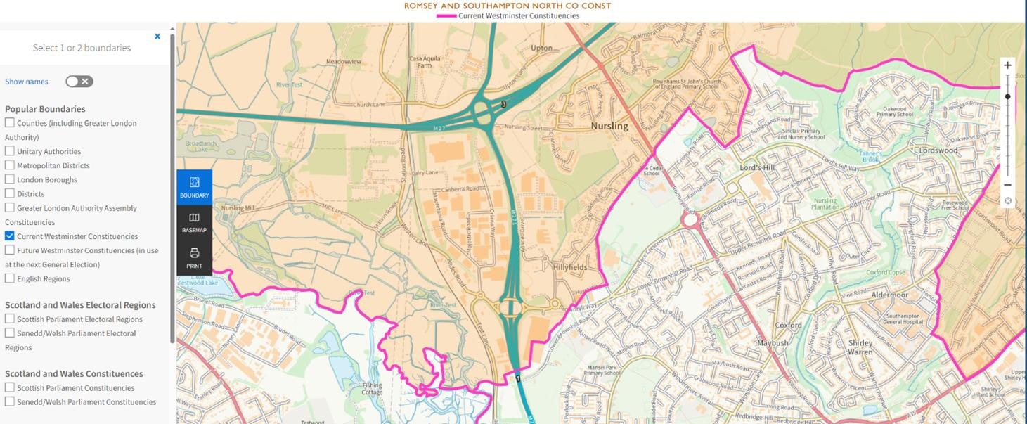
For example, below is a screenshot of the election maps, centred on Explorer House (OS HQ) in Southampton. The darker shaded area is the constituency in which it sits, Romsey and Southampton North, while also demonstrating where it’s located close to the boundary with Southampton Test.
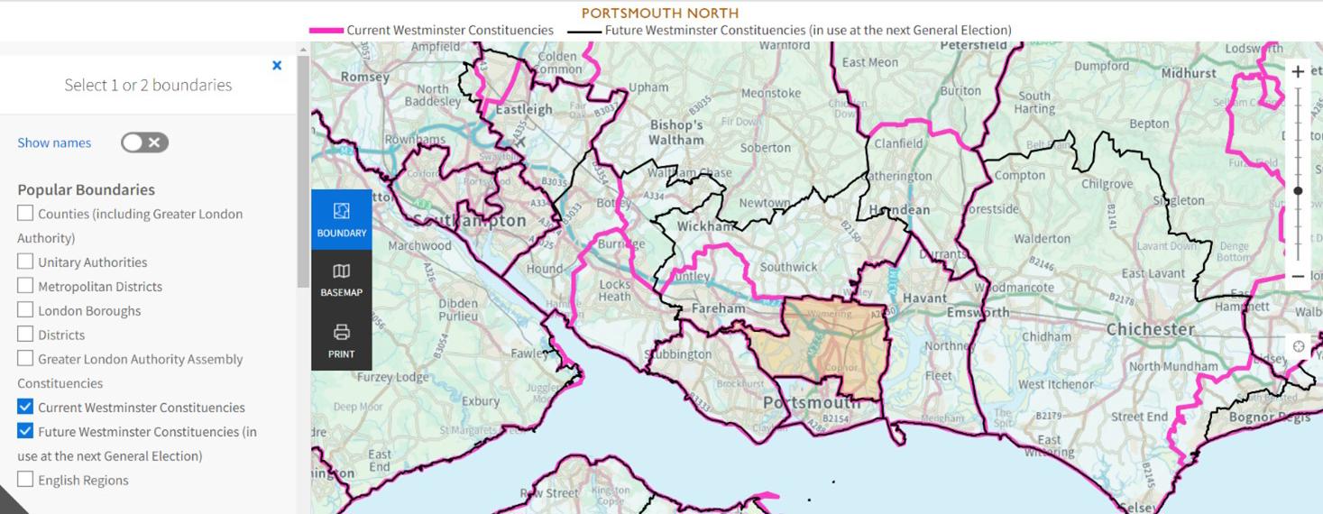
There is an option to select two different types of boundaries simultaneously, allowing you to view and compare the data. The image below shows some differences between current (pink line), and future (black line) Westminster Parliamentary Constituency Boundaries, in Hampshire. The differences between the pink and black lines help demonstrate where and how constituency boundaries will change.
You can choose from a variety of administrative and electoral boundaries to overlay on the political map. The maps clearly show the electoral constituencies against various scales.
This information will be particularly useful for elected representatives, election managers, candidates, and party workers. Local authorities can also use the data to help facilitate election planning, including decisions on the location and resourcing of polling stations.
Try it now: Election Maps (GB) and Election Maps (NI)
Boundary Line open data
In addition to the election map, all users can download two related products:
- OS’s existing Boundary-Line data product to help prepare for and analyse local and general election results.
- The future Westminster Parliamentary Constituency boundaries data
The datasets are available for free. Boundary-Line can be downloaded in a variety of different formats from the OS Data Hub, and the Future Westminster Constituency boundaries data can be downloaded from the Boundary-Line Technical information page on the OS website.
Why are there current and future constituency boundaries?
Parliamentary constituency boundaries are reviewed on a regular basis, then amended as required to reflect the changes in the electorate. While the current parliamentary constituency boundaries are still in place until a general election is called, the new future constituencies boundaries have been published alongside them to allow accurate and authoritative data to help the preparations for the future General Election.
There are four Boundary Commissions, for England, Scotland, Northern Ireland, and Wales. OS has historically provided support, offering expert mapping advice to the Commissioners who will make the final decisions on all electoral boundaries. When the reviews are complete, and the relevant legislation passed, OS absorbs those boundary changes into our products and releases them.
OS has a statutory role to support electoral mapping, enshrined in the UK Parliamentary Constituencies Act 1986.
Great Britain election map

Our highly accurate geospatial data and printed maps help individuals, governments and companies to understand the world, both in Britain and overseas.
Products and solutions featured in this blog
Boundary-Line
Ordnance Survey's Boundary-Line™ is an open dataset of every administrative boundary in Great Britain.