Groundsure improves access to key environmental data
Ordnance Survey (OS) Partner, Groundsure, empowers customers to make sustainable land and property decisions.
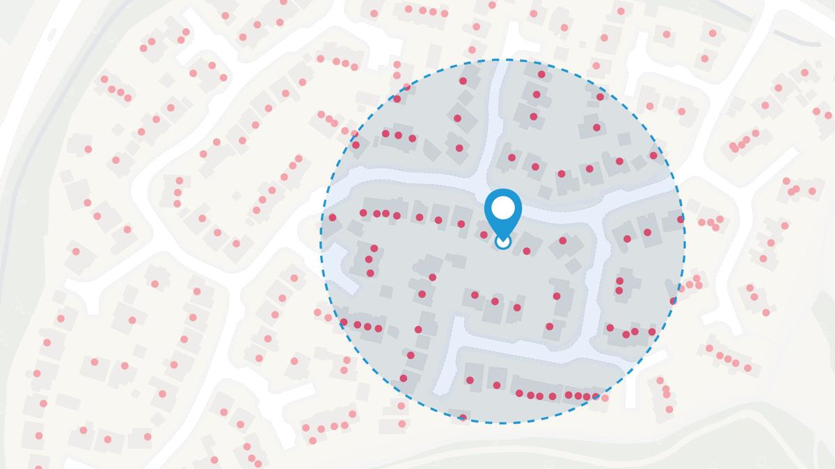
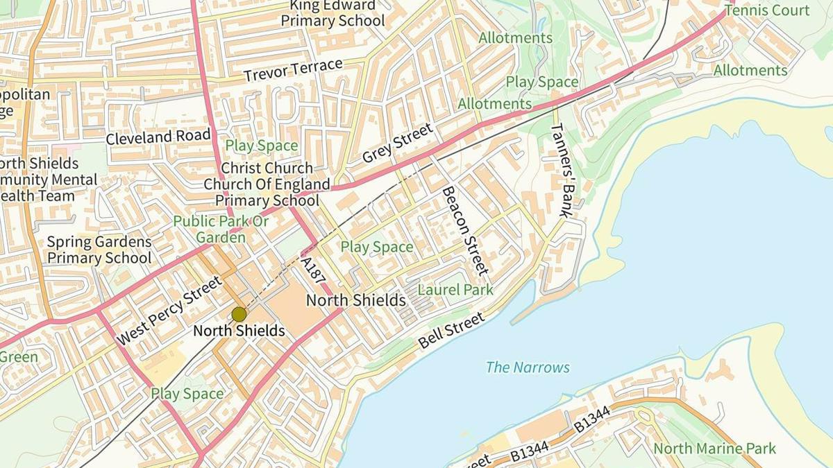
The ‘free, trusted data viewer’ shows data layers including flood risk, mining data, conservation zones, and much more – meaning customers can achieve all their work in one platform, creating efficiencies and saving time.

"The groundsure.io platform was built to address a key pain point experienced by environmental professionals due to the disjointed availability of environmental data. At Groundsure, we had previously created solutions to serve later stages of workflow when detailed data was required at cost. By giving free access to national scale baseline data across a variety of themes and creating efficiencies in site identification – using definitive Ordnance Survey mapping – we’re now providing a valuable service from the earliest stages of a project."
As well as allowing users to view environmental data, groundsure.io allows customers to order many of the Groundsure reports and manage their organisation accounts and ultimately workflow. Groundsure is working closely with its client base to unlock further potential for the platform.
Groundsure.io allows its users to find answers to their questions in one ecosystem by bringing various sources of data together. They can find and map their site locations using the most detailed and accurate view of topography alongside authoritative address information. There are also over 50 datasets from providers such as the British Geological Survey, Coal Authority and other regulatory bodies. Assessing their site and obtaining their required reports is all achieved in one platform, which previously would have required multiple webpages and applications.
"The future of .io is in doing more to join the dots; to provide a wraparound workflow solution that drives further efficiencies for our customers. "
Groundsure is a certified B Corporation – a group of just 1500 UK companies that place customers, staff, community, and the environment at the heart of its decision-making. They take large and complex environmental and climate data and turn it into clear and simple insights to help customers, from architects to conveyancers, to environmental consultants.
Groundsure used Ordnance Survey’s addressing and mapping API to underpin the service. The OS Places API allows users to find the location they need with up-to-date, accurate address information. To help customers define their site OS Vector Tile API is used to provide access to definitive topographic data. This also allows them to easily see and select the underlying topography to help build out their site boundary.
To learn more about Groundsure and how it can help you, visit its Meet the Partner page.
Introducing our Partner Programme
Our new OS Channel Partner Programme provides the basis for closer collaboration and our commitment to supporting the Partner lifecycle – from recruitment, through development, and on to independence – plus incentivising and supporting Partners to deliver increased sales.
Our highly accurate geospatial data and printed maps help individuals, governments and companies to understand the world, both in Britain and overseas.
Products and solutions featured in this blog
OS Places API
Perform accurate geocoding and reverse geocoding with our secure, scalable, and resilient address API.
OS Vector Tile API
A vector tile service providing detailed Ordnance Survey data as a customisable basemap.