OS Emergency Services Gazetteer
The Emergency Services Gazetteer provides a national, consistent, and maintained view of the locations and names of places and objects.
This product is updated monthly
The Emergency Services Gazetteer provides a national, consistent, and maintained view of the locations and names of places and objects.
This product is updated monthly
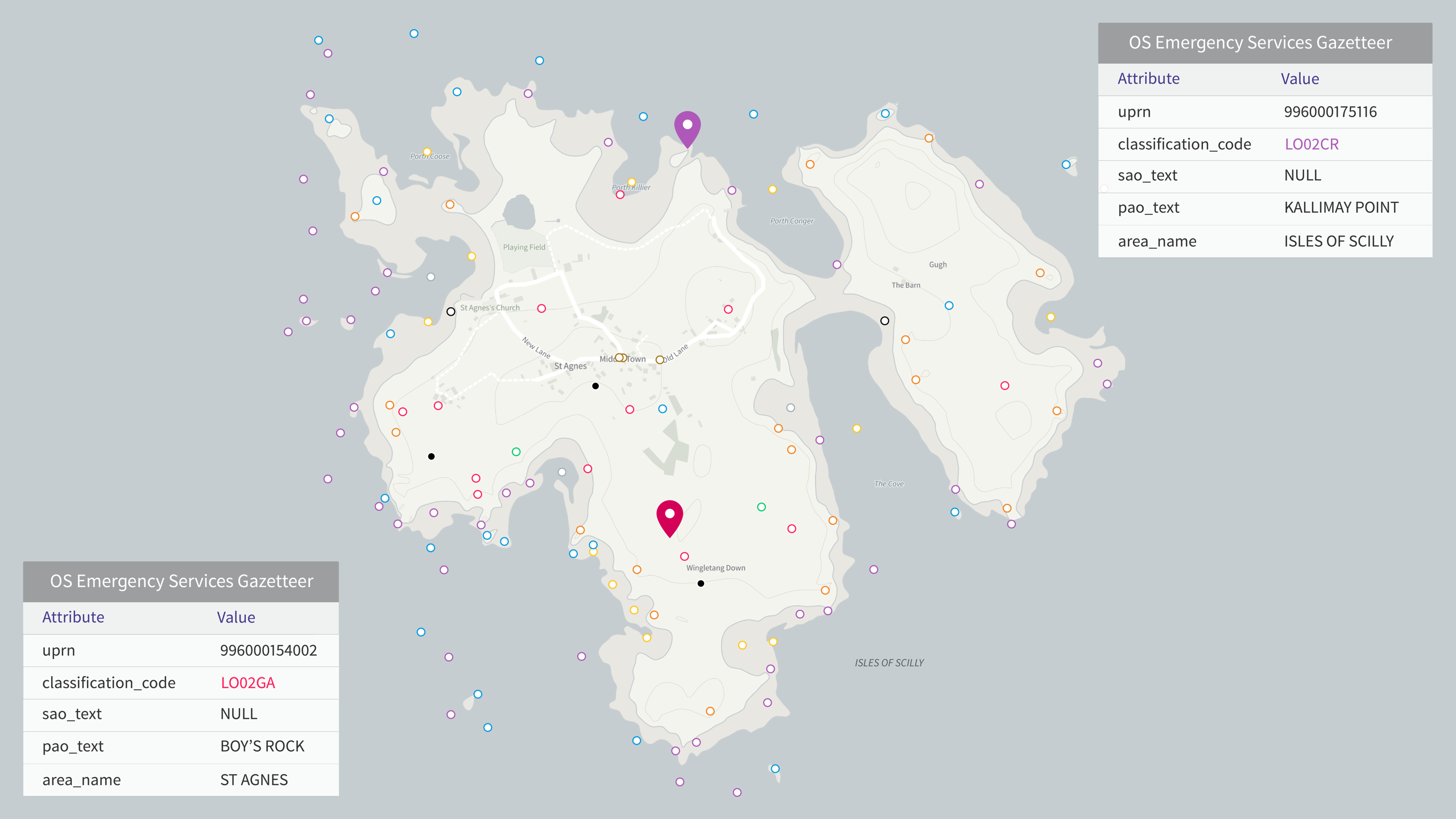
The OS Emergency Services Gazetteer is easily filterable allowing you to be able to select the features that you are interested in, based on the classifications allocated to those features.
The gazetteer provides a single centralised source of information which allows for an easier, faster and more precise identification of a location.
Download a small area of OS Emergency Services Gazetteer.
Or try out the real thing by applying for a Data Exploration Licence
Supporting in emergencies
Using our ability to analyse and collate information the OS Emergency Services Gazetteer provides emergency services the data needed to estimate emergency response times.
Aiming to improve the recording of road traffic incidents
Analysing trends and patterns of road traffic collisions to help identify risk and support incident planning.
Working to improve public safety
The OS Emergency Services Gazetteer enables emergency responders to be more accurately informed, improving response times and public safety.
Download a small area of OS Emergency Services Gazetteer.
Or try out the real thing by applying for a Data Exploration Licence
Ready to get started with our data and APIs?
Choose your plan and create your account. Take the next step by signing up to the OS Data Hub and create your first project today.
Download Premium data from the OS Data Hub
If you're an OS Licensed Partner you can use the OS Data Hub to access OS data products and manage your account all in one place.
OS Data Hub for PSGA members
If your organisation is a member of the Public Sector Geospatial Agreement, access the OS Data Hub to access our products.
For further help about how our data can transform your organisation, contact us today
Contact us